Verona Resia Verona • Traguardo Volante
Verona Resia Verona • Traguardo Volante
Saturday 5 and Sunday 6 June 2021
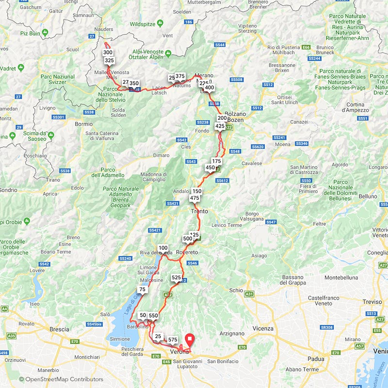
The route starts from the magnificent Villa Guerrina of Montorio and ends at the sources of river Adige close to Resia Pass, few meters away from the Austrian border.
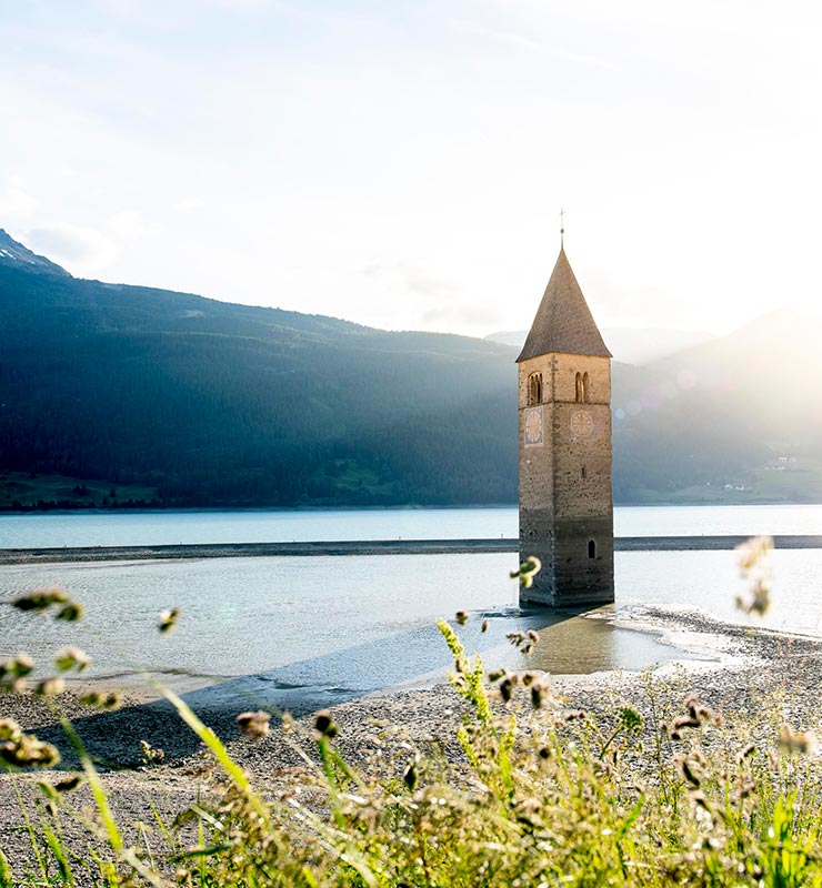
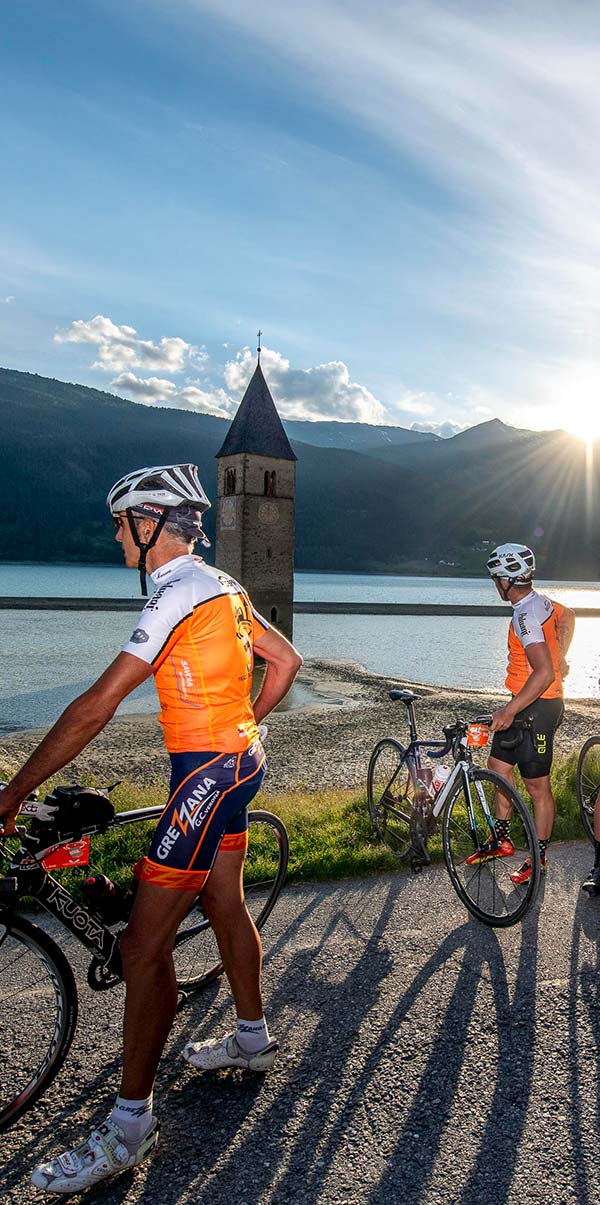
In Resia, after admiring the submerged bell tower in the blue lake, you will start the way back to Verona, mostly downhill. The first part of the route is quite various compared to the second.
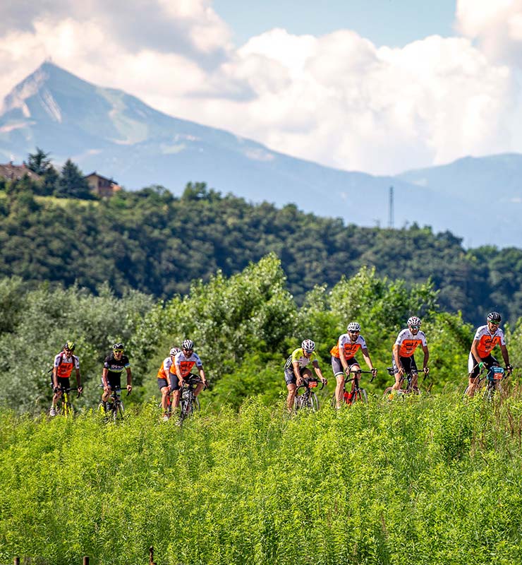
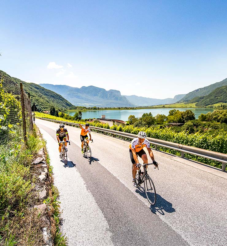
Along the same stretches the views are different: from south to north you can observe the Alpine region, whereas on the way back down you will admire the plain which becomes wider and wider.
You will pass through the heart of Verona, reaching Garda Lake until Riva del Garda. From here you will turn towards Mori to get in Vallagarina (Lagarina valley), the big valley of Adige river. You will ride through Trento reaching Caldaro Lake, then on until Appiano along the “Strada del vino” (wine road) and we will come down in the direction of Bolzano.
For the participants who chose the 300 km route, this is the final destination of the Randonnée; you still have the chance to choose at any moment, depending on the physical and weather conditions, to go on and try the 600 km route, even if it wasn't planned at the beginning.
After Resia, you will return in Val Venosta (Venosta valley) and you will follow the long Val d’Adige (Adige valley). In the Veronese territory, you will ride on the left side of the river, along a recent bike path that passes through Ceraino weir, overlooked by the Rivoli fort, that stands on the top of a hill.
From here, you will reach Valpolicella in short time. The route follows, as much as possible, the bike paths that are present in the territory: we want you to ride safe and relaxed, enjoying the surrounding breathtaking landscapes. Since no street is reserved or closed to traffic, we recommend the maximum respect for the riders and the pedestrian that you will find along the way.
TWO RANDONNÉEs
Lenght 300 km – Altitude +2.400 mt
Lenght 600 km – Altitude +3.700 mt